Creator: Service du Cadastre du Sud-Vietnam
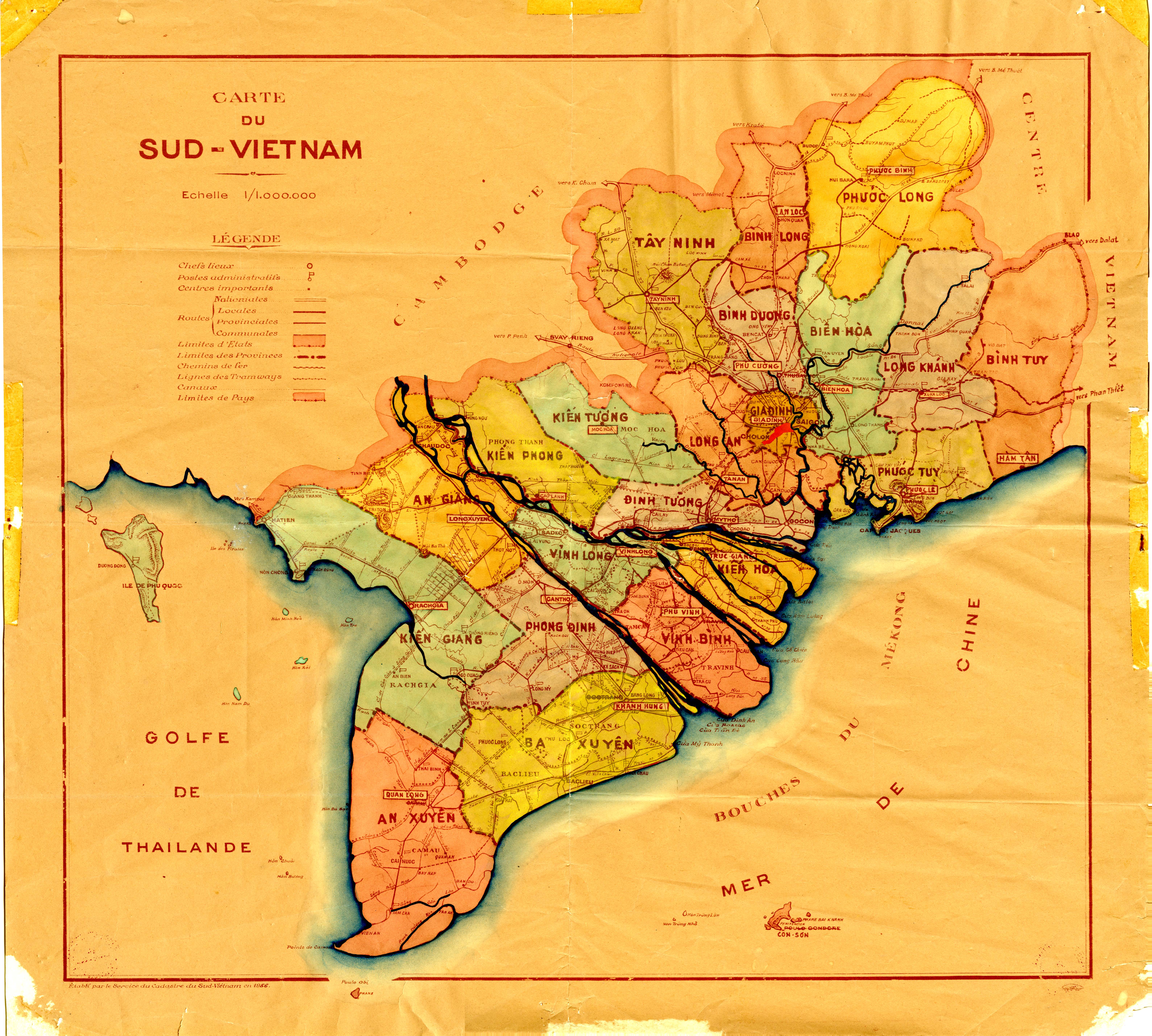
Description: This document is a 1956 map in French of the various provinces of the Republic of Vietnam.
Digital Format: Image/jpg
Language: French
Original Date: 1956
Date Range: 1950-1959
Source: Michigan State University Archives & Historical Collections Wesley R. Fishel Papers (UA 17.95)
Pages: 1
Identifier: UA17-95_000351_Final.jpg
Country: South Vietnam
Digitizer: MSU Archives and Historical Collections
Rights Management: Educational use only, no other permissions given. Copyright to this resource is held by Michigan State University and is provided here for educational purposes only. It may not be reproduced or distributed in any format without written permission of the MSU Archives & Historical Collections.
Contributing Institution(s): MSU Archives & Historical Collections; MATRIX: The Center for Humane Arts, Letters & Social Sciences Online at Michigan State University